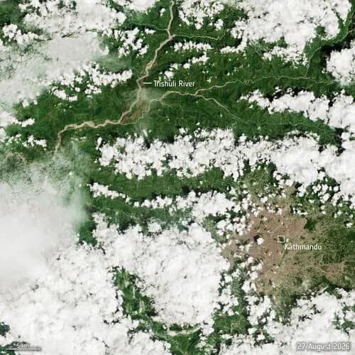
A catastrophic flash flood struck northern Nepal on 26 August, and satellite imagery is now revealing the scale of the inundation and devastation. The Copernicus Sentinel-2 mission captured the aftermath, providing a detailed look at the affected region.
Thousands of emergency responders are conducting search-and-rescue operations in the wake of the disaster. The satellite data helps illustrate the extent of the flooding, which is essential for coordinating relief efforts.
Sentinel-2 captures the flood's footprint
The European Space Agency (ESA) released the imagery on 31 August, showing the flood's impact across northern Nepal. The images allow responders to identify the hardest-hit areas and plan their operations more effectively.
Search-and-rescue operations continue
With thousands of responders on the ground, the satellite imagery serves as a critical tool for mapping the disaster zone. The data reveals the scale of the devastation, aiding in the allocation of resources and the prioritization of rescue efforts.
The full extent of the damage is still being assessed, and the ongoing operations will rely on continued satellite monitoring to track the situation as it evolves.